The Minnesota food blog Heavy Table published a book in 2013, the Secret Atlas of North Coast Food. I was brought in to fill a scheduling challenge from one of the original cartographers, and ended up doing three maps for the project:
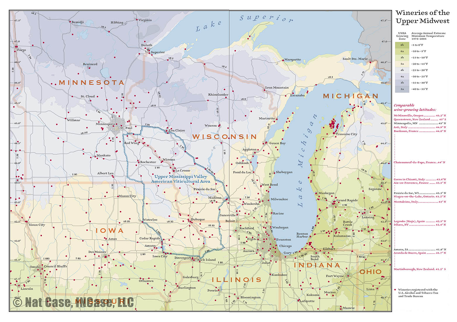
For an article about viticulture (grape growing) in the region, I made a map based in large part on map styles from the early twentieth century, an era I’ve been looking for chances to explore. It uses the new USDA growing-zone lines as a base point, and colors adapted from John Bartholomew and Sons maps. For data points showing wineries, we ended up using data from the US Alcohol and Tobacco Tax and Trade Bureau. One of the interesting aspects of working with this older style is that the base linework is all in one color, so you can do some interesting things with overprinting and masking.
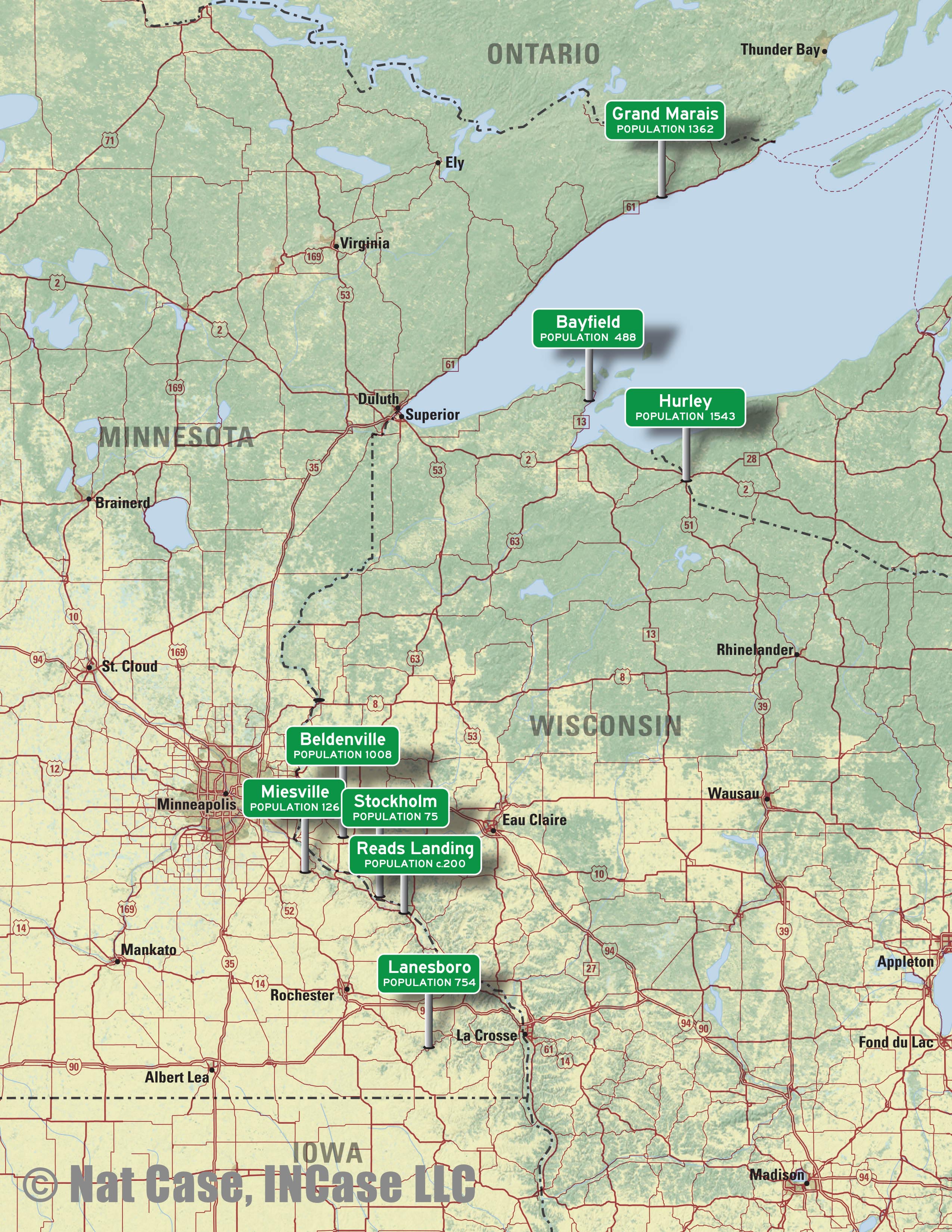
For an article called “Small Towns, Good Eats,” I made a simple Natural Earth background and put “now entering” road signs planted at the locations of towns discussed in the chapter. I thought it was interesting what a cluster Lake Pepin area towns made.
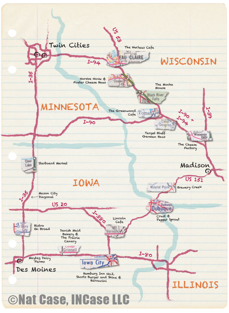
Finally, for an article on roadside food, I took little clips from a bunch of historic road maps, and collaged them in place against a heavily-brushed, super-simple map of the triangle of Minneapolis-St Paul, Des Moines and Madison. Probably a coffee-ring stain would have been appropriate, but I thought enough was enough. This one was the most fun of the bunch to do.