This map base was part of a never-completed publication developed through the Furthermore Foundation in Hudson, NY. The map highlights natural and cultural heritage features in the central Hudson Valley, emphasizing the “viewsheds” that Hudson School painters used in their work, and the pattern of large estates that still dominate the landscape. We worked with the graphic design firm Doyle Partners in New York City to develop the map style, and with Stuart Allen Cartography in Oregon, who are masters at shaded relief. Selection of point of interest information was coordinated with Hudson River Heritage, the content editors for the overall publication.
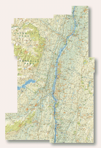
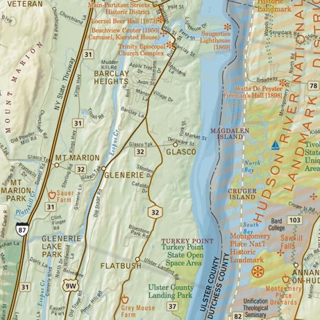
The map content involved a lot of original research, particularly in locating shapes of privately held open space. Road data was a challenge; we spent considerable time editing official data sources to match actual road conditions and correcting name information. With no single source of information on points of interest, we ended up essentially editing a visual guide to historic and cultural landmarks in the area.