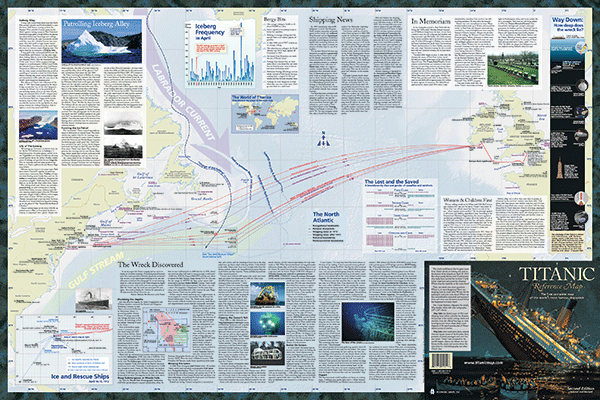
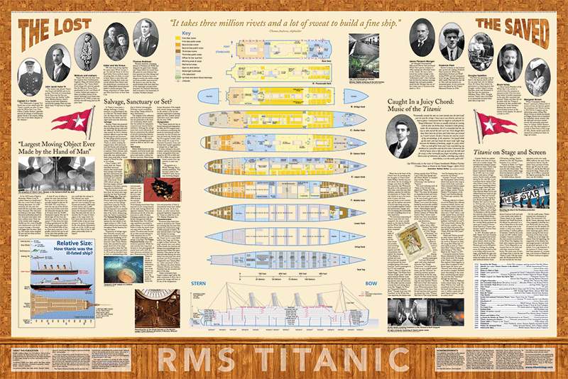
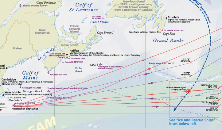
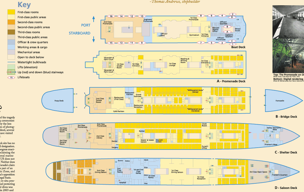
Titanic Reference Map – Hedberg Maps, Inc. / Map Link
Vermont Book Awards, Honorable Mention 1999
It was the spring of 1998, and the production office of Hedberg Maps (then in White River Junction, Vermont) had a visit from Bill Hunt of Map Link, Inc., who had just himself visited with a retail client. When asked what they most needed in terms of maps, the client had said, “Well, if you had a Titanic Map, we’d sell a ton.” By the end of the day, we had a handshake agreement to develop the map for them.
We knew we had a limited time window, so we scrambled to work. Writer Lynn Noel headed up content development, I worked on a layout and co-ordinating visual elements (including lots of image acquisition and licensing), Don Marietta worked on information graphics, and everyone from Hedberg Maps and Map Link looked over everyone else’s shoulders to make it come to life. A crazy two months later, we had printed maps in hand!
The map was honored at the Vermont Book Awards in early 1999. It is still available from Hedberg Maps, and was the basis for a National Geographic edition in 2012.