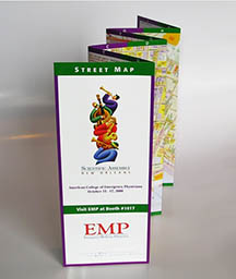
New Orleans Map – Emergency Medical Physicians / Hedberg Maps, Inc.
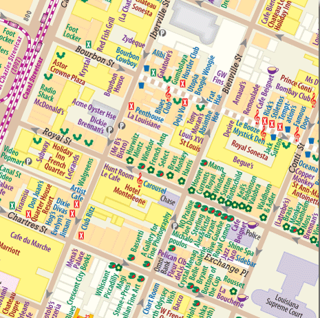
Emergency Medical Physicians was a long-standing client of Hedberg Maps, hiring us over many years to make a map for the American College of Emergency Physicians annual conference. In 2006, ACEP was the first major conference to meet in New Orleans after 2005’s Hurricane Katrina. Though we often licensed other cartographers’ artwork, we couldn’t find any that had been updated post-storm. Actually, we couldn’t find any that were as detailed for the French Quarter as we would have liked; for such a walkable city, it was amazing that no one had published a building-level map. So we did it.
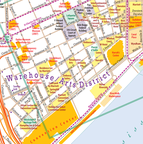
We used aerial photos by FEMA to draw initial building shapes. I went down for field work in July (let me just say for the record that this is not the best month to do outdoor field-checking in the Deep South). The map locates those retail types tourists flock to: bars and adult clubs, of course; live music, fine dining, and also arts and antiques, and GLBT-friendly venues. We included insets of the greater region and the Garden District, and gave the best information we could on when facilities that were still closed would reopen.
The map was adapted by Hedberg Maps into a retail publication.