Naval historian Steve Harding had worked with Hedberg Maps previously on a project exploring trans-Pacific shipping—we helped him by creating graphics thst showed time zones current during the Second World War, between the western coast of North America and Hawaii.
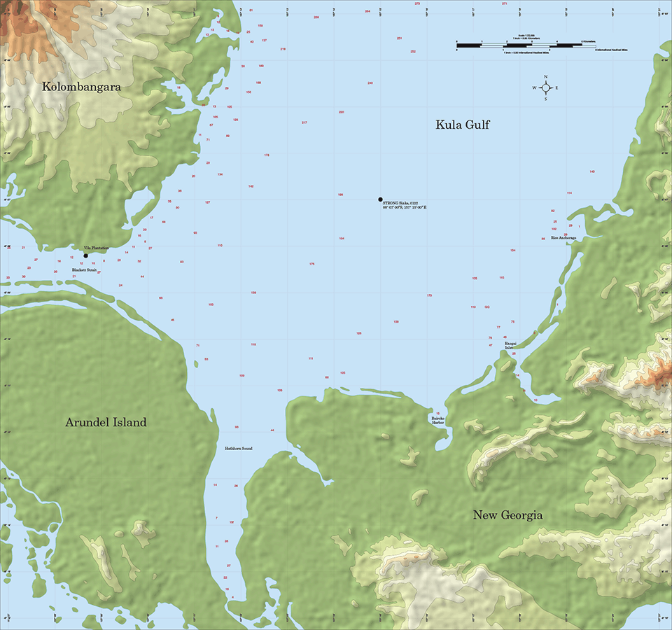
For a new project on naval actions in Kula Gulf in the Solomon Islands, Steve needed a map that detailed elevations and depths. The challenge was putting together the data: a 1970 survey map at 1:50,000 had great elevation contours… but left out the island in the northwest corner, the one with the dramatic elevation. Recent satellite photography was excellent for coastline detail (though one had to work around cloud cover), but the major international sources of elevation data looked very pixillated. Current navigational charts from major international sources, and the 1938 chart we found at the National Library of Australia had a coastline that was quite distorted.
But I fit the best sources together I could, graphically pulled them together, and Steve said he was delighted with the result.