High Points fact card – Atlas Facts
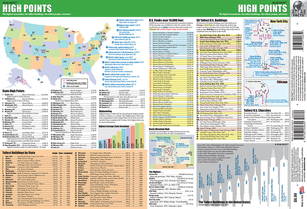
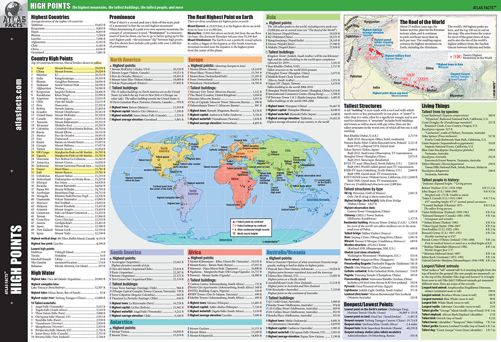 For the first of a new line of fact cards, Atlas Facts wanted to look at high points—the tallest point in countries and states. We expanded the scope to include tall structures, human feats of altitude, tall trees and animals, and all kinds of fun bits and pieces about how high up and low down things are on this planet. I compiled most of the data and created the layout within a framework provided by the client. I began with a more map-based concept, but it became clear this needed to be more about the lists than the graphics, so we rebalanced the content so the maps and other infographics would balance and break up the text and tables, instead of dominating them. I developed a nearly-complete state which was completed by staff at Atlas Facts.