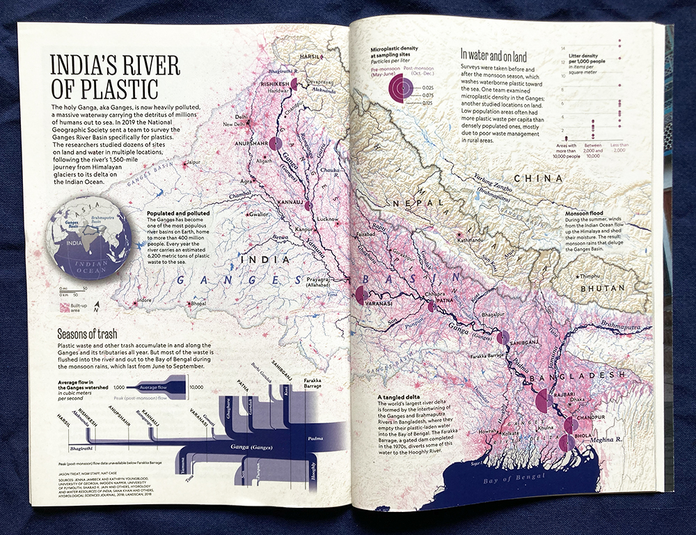
 Working with Jason Treat, who designed the page, and other staff at National Geographic, we set out to illustrate an article in the April 2022 issue of the magazine about plastics pollution in the Ganges. The Ganges Plain is one of the most densely settled parts of the world, and the annual monsoons wash enormous amounts of material, including trash, out to sea. The map shows populated areas in pink, the relief of the Himalayas in tan, and the river network in blue.
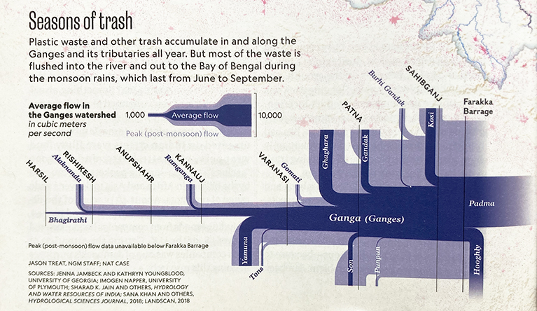 Of special interest was showing the actual and massively variable flow of rivers, as tributaries add to its volume, both as an annual average and a typical post-monsoon maximum. The data for this was surprisingly hard to come by: India does not make the point gauge data public. So the Sankey diagram I pulled together came from a variety of papers, reports, and other sources, and is probably the most complete such diagram ever published!
The maps are all copyright National Geographic Partners.