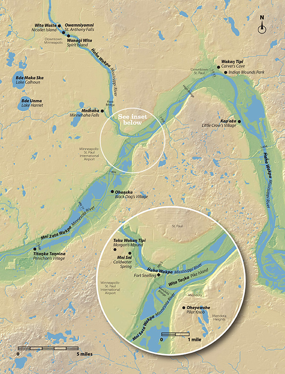
 For their heavily illustrated book about the area around Fort Snelling as interpreted from a Dakota point of view, Minnesota Historical Society Press needed a locator map for the Dakota places mentioned in the text. The challenge was how to make a map of a heavily urbanized area that on one hand deemphasized what I came to think of as “colonizing” marks—municipal and county boundaries and the street grid, and on the other hand didn’t pretend this is a land before the history of European settlement. I ended up using a color-graded relief image from the state LIDAR program, which shows the marks made by nearly 200 years of colonization—the cuts and fills of rail and highway construction, and quarrying pits. I very lightly indicated some landmarks: the bridge crossings of the river valleys that dominate the map, and the airport and downtowns nearby. The result is a full-page map.