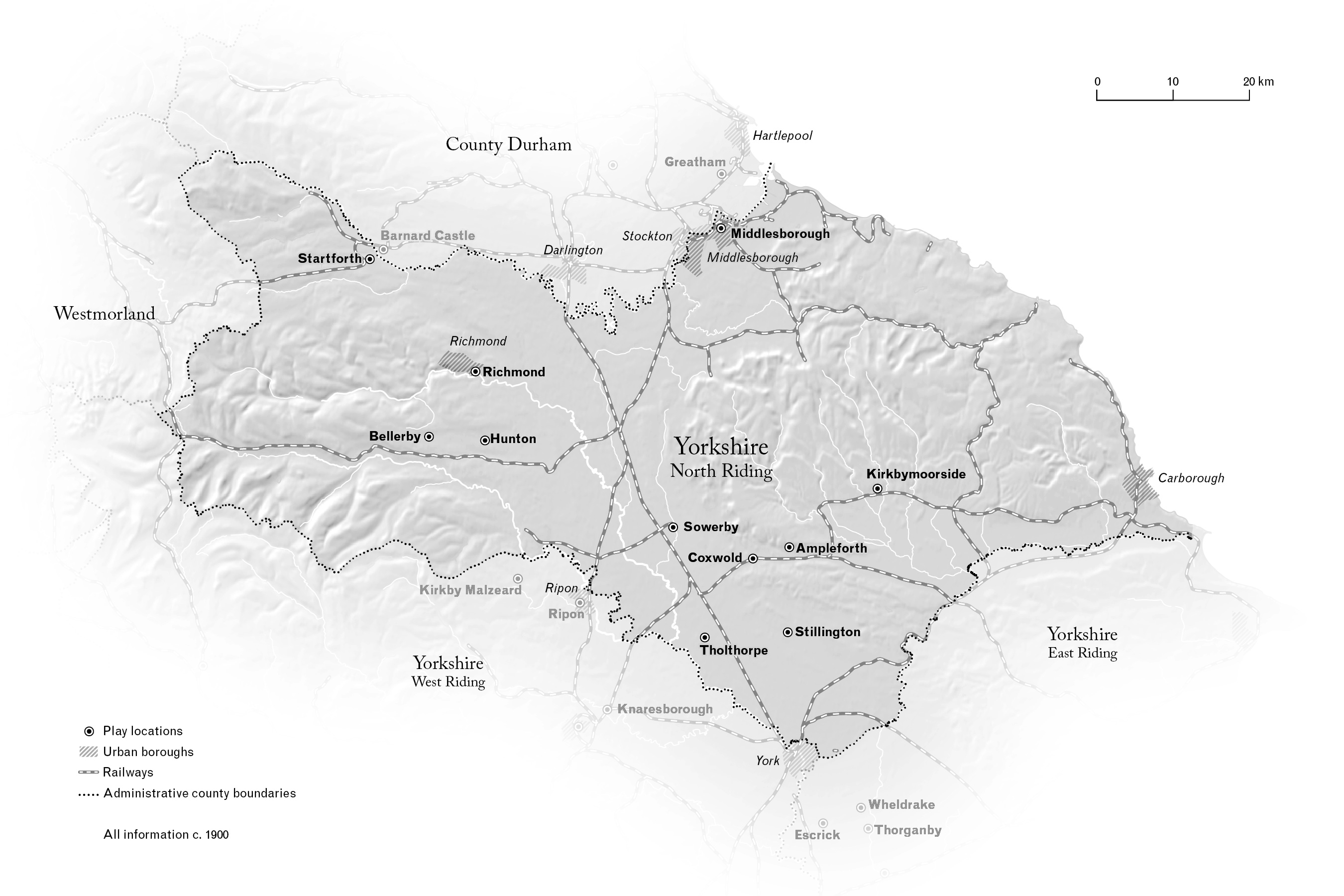
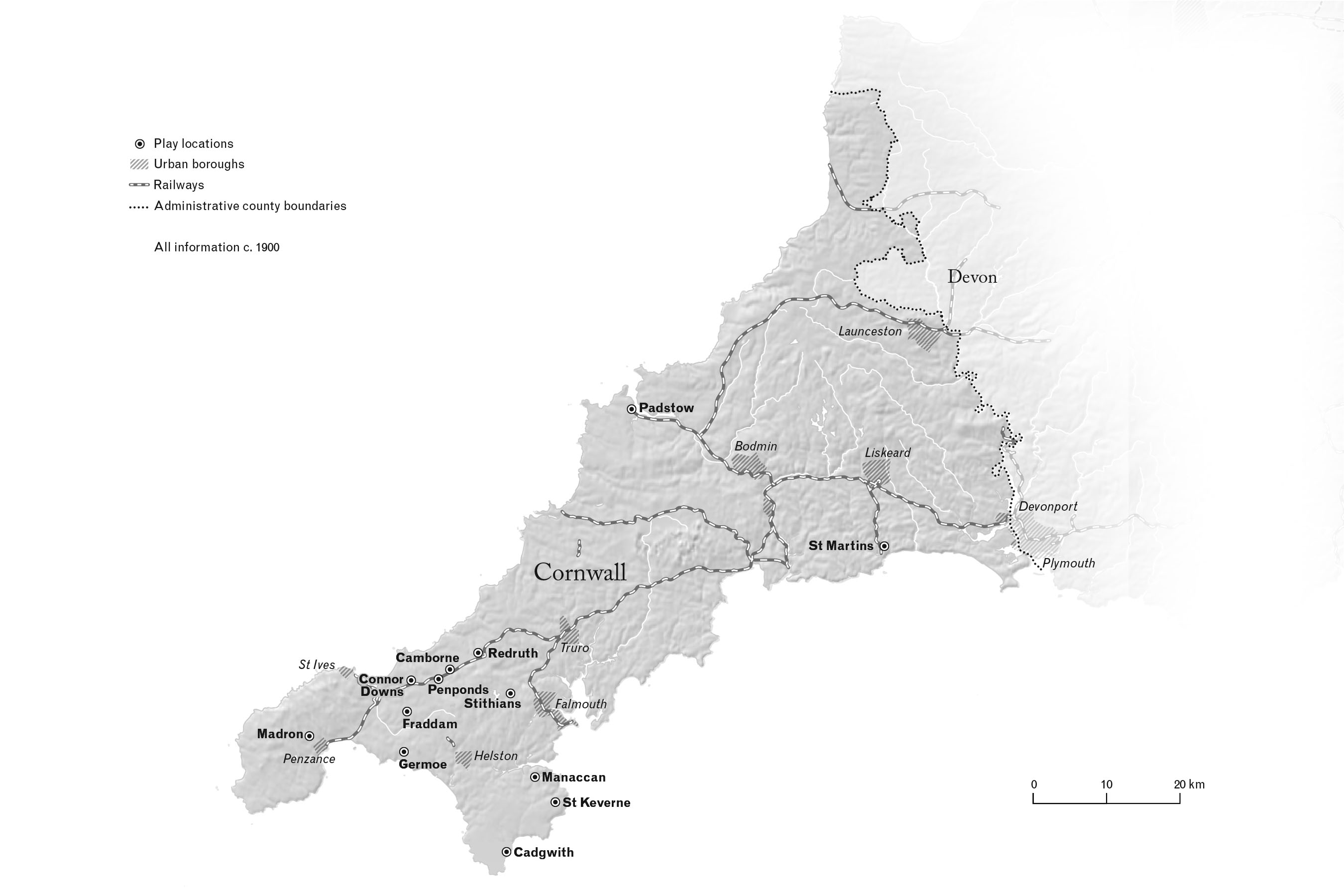
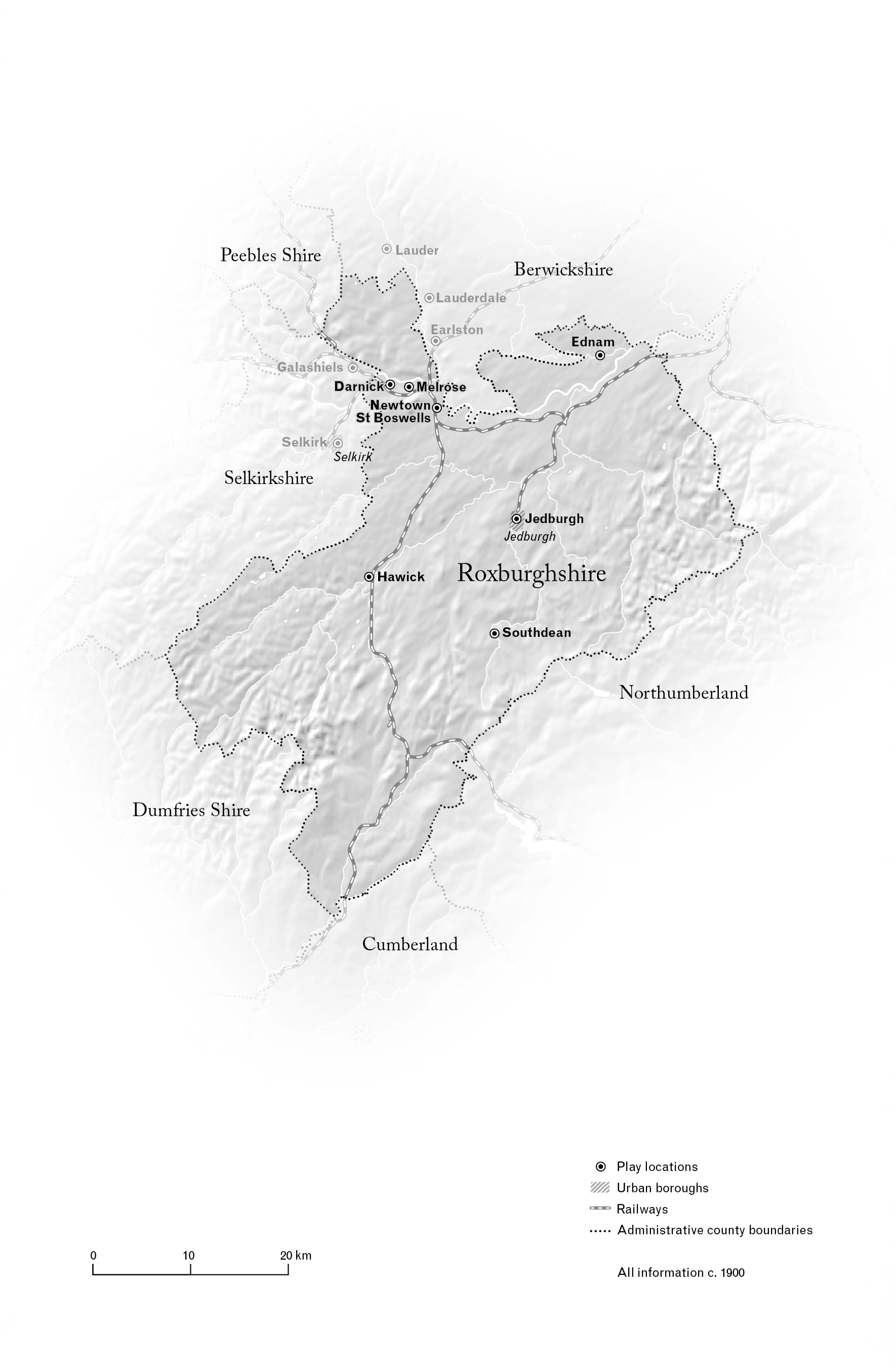
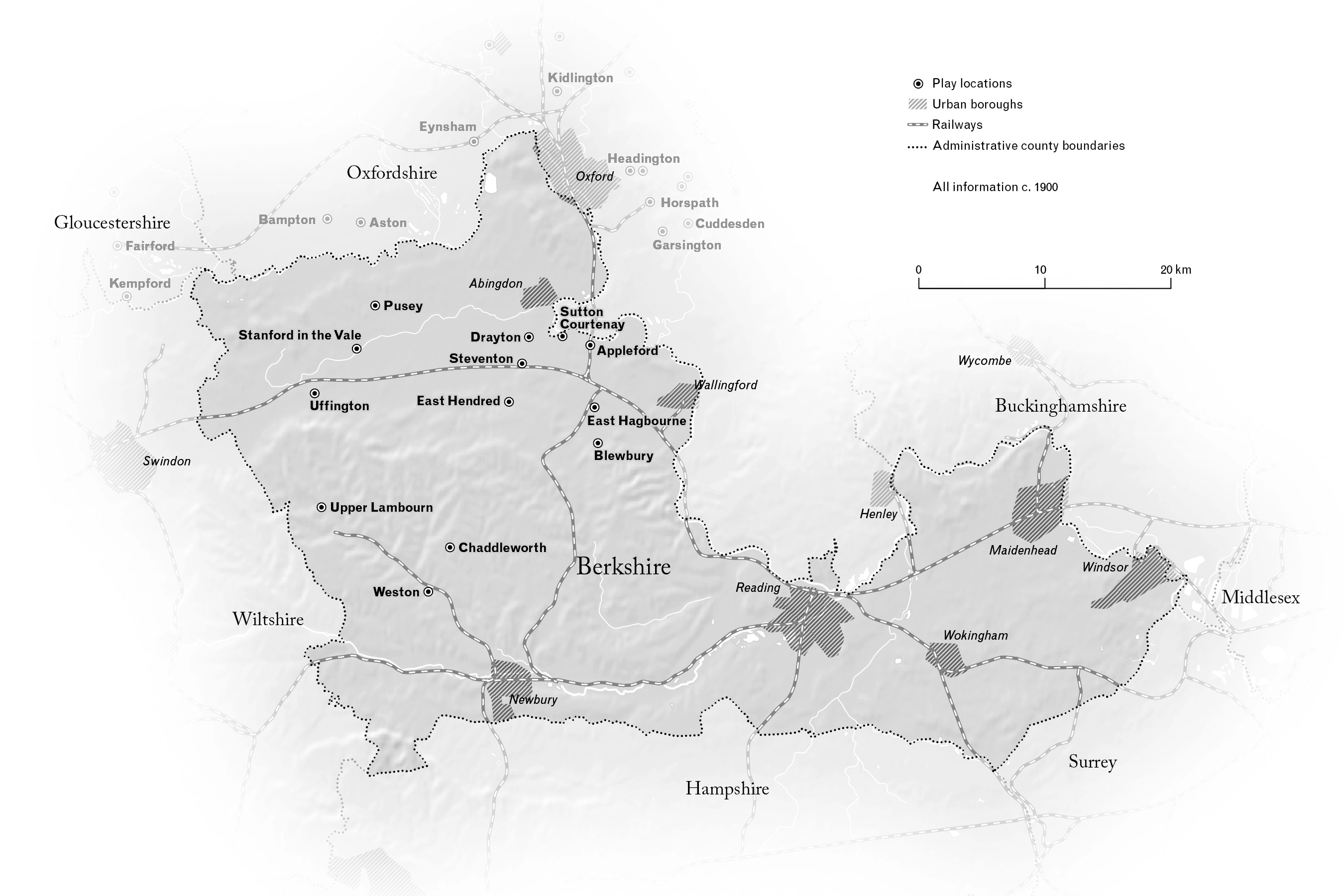
J.M. Carpenter collected a wide variety of folk material, musical and not, between 1927 and 1955. Included in the collection, which is just now being edited for publication, is probably the largest single collection of British folk plays. English folklorist Eddie Cass is editing this portion of the collection, and he wanted maps showing the plays’ locations within English counties—the historic counties. The challenge is, those historic counties were far from static, and there existed two parallel systems of counties during the period when the collected material was “active,” which in turn is several decades before it was actually collected. We settled on using Administrative Counties as of 1900. I used data from the Vision of Britain project and the Ordnance Survey, corrected using a 1901 atlas map by Stanford’s. Shown here are drafts of four of the maps.