Runner-up in the Avenza Map Design Competition 2021
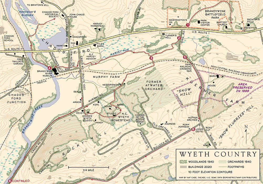
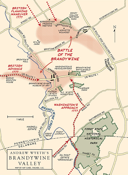
For his narrative and guidebook to the Chadds Ford, the home base (and subject) of several prominent American artists including Andrew Wyeth, the author brought me in to execute two maps. He provided some genuinely spectacular sketches for content and area of coverage, and gave me a great head-start. I was looking for a style that echoed early-20th-Century landscape maps, and borrowed some of the stylistic tools from my maps of the Carleton College Arboretum. The Wyeth Country map is a two-page spread, which includes routes to several walking/driving tours of the area, and the Brandywine Valley map is one page and focuses on the basics of the 1777 Battle of the Brandywine.
The Wyeth Country map in particular required some reconstructive work: Pennsylvania has aerial photos from c. 1940 that were useful in matching to modern features, and I ended up building out the modern building base for the area in OpenStreetMap. I’m always fascinated by looking at and trying to communicate changes in a landscape over time, and especially when you don’t have the luxury of separate “then” and “now,” it can be a challenge to get viewers to line up the two and understand the changes.