 [click on thumbnail to view]
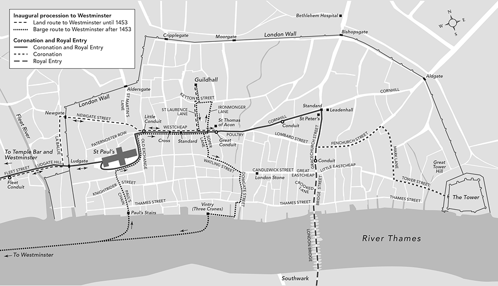
The challenge here was twofold. First, come up with a London basemap that reflected the state of the City of London near to the early 15th Century. We ended up starting from a considerably older state, because that’s what we could get sufficient detail for, and then worked forward. We wanted to show actual street widths, as opposed many of the source maps which used a uniform line width. And we needed to keep it simple because…
Second, the overlapping routes that needed to be distinguished took a surprising amount of time to clarify so they would make sense to the reader. We tried overlapping wide and narrow, light and dark lines, but in the end varying dashes and parallel, non-overlapping lines was the clearest.
Professor Hanawalt’s book will be published later in 2016 by Oxford University Press.