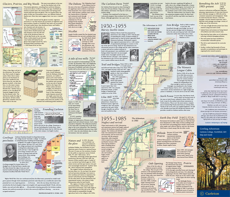
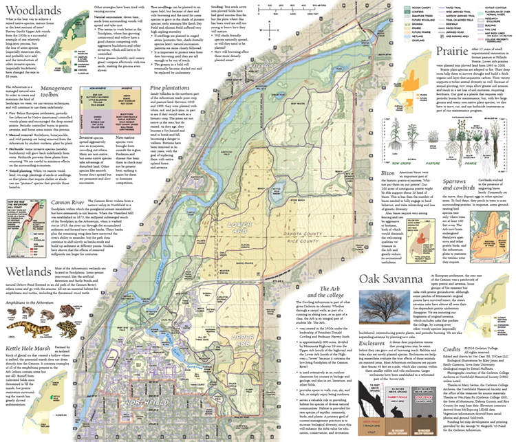
Cowling Arboretum Map – Carleton College
This is really a labor of love for me. I made the official map of the arboretum at Hedberg Maps for almost 20 years, and then had the chance to create an entirely new piece, focused more on interpretation as several of the practical functions of the old map had been superseded by mobile technology.
The map is divided into two sides, one that talks about the Arb and its context over time, and one that talks about the ecosystems of the Arb today and the work the college is doing in and about the Arb. I created all the textures from scratch, inspired by the kinds of textures one might find in park maps and diagrams from 100 years ago…
And there was tons and tons of research involved. Fascinating stuff about the rapid creation of the city of Northfield in the 1850s and 1860s; the effects of the milldam in the northern part of the Arb, from the 1870s until 1915; and the questions of what sorts of plants, non-native and/or invasive, are problematic for maintaining the ecosystem, and how preserving a more-or-less native biome is pretty much impossible, a matter of triage and management.
Daniel Huffman worked on the geologic/glacial diagrams, and Emily Cisneros and Riley Jones, students at Iowa State University, did the biological illustrations.
 You can view the map full-size here.