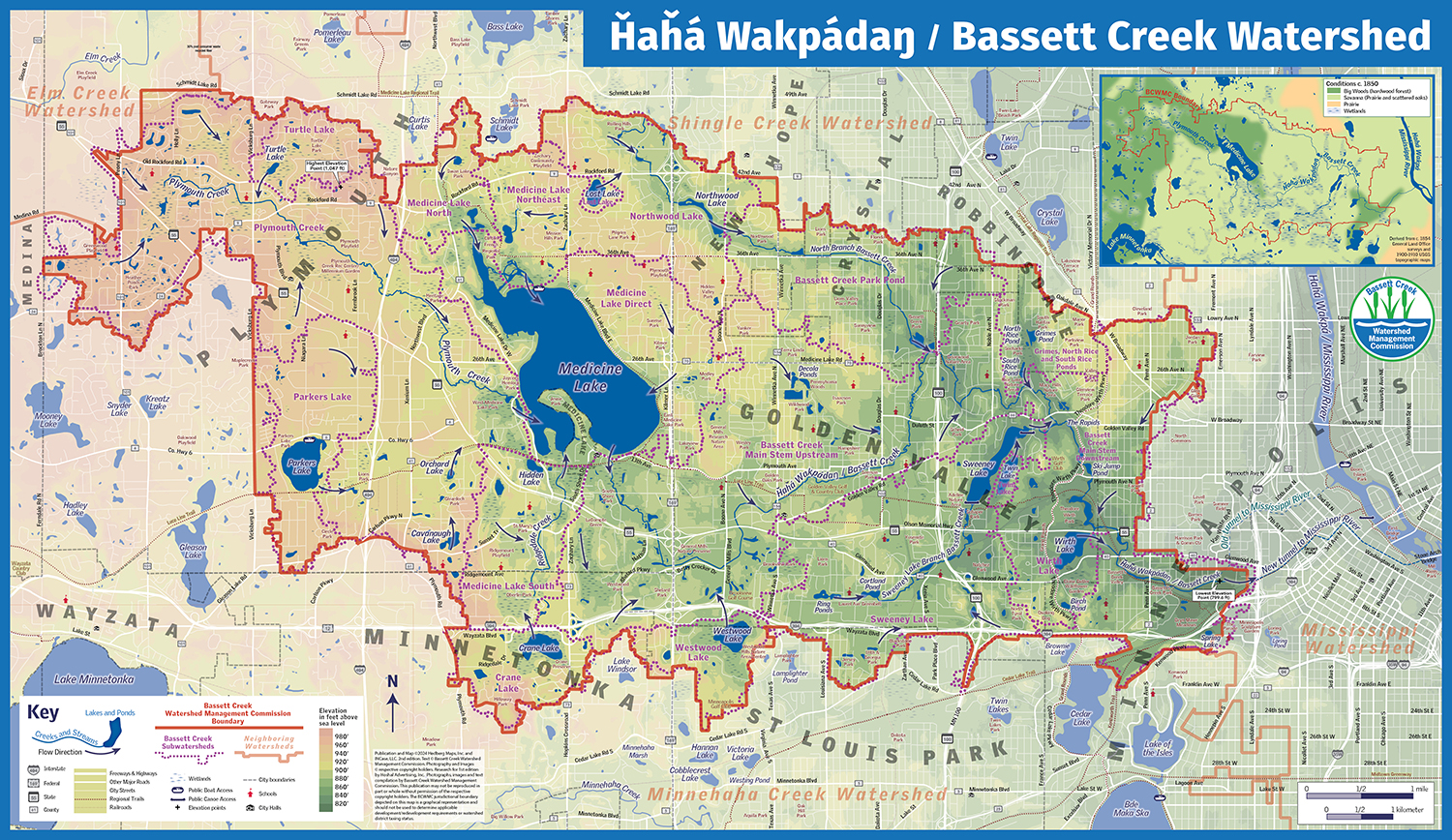
Bassett Creek Watershed Management District
For a new edition of their map and guide, the watershed district chose to emphasize the landforms and water flow over political boundaries and built infrastructure. The map is used in education programs, so giving students a tool to understand how water flows through their community is a primary focuse. The map also was previously done in a throwback style and graphics, and the district wanted a more contemporary, neutral frame. Finally, they wanted to incorporate the main stream’s Dakota language name, and information by and about the Dakota heritage of the area. I worked with them to pull all these together, including map design on the main map and several smaller maps, the layout, and sourcing illustrations for the publication. It was over a year project, but we were all happy with the result!