A Numeric Topology of the Eisenhower Interstate Highway System – Hedberg Maps, Inc.
The idea of making a schematic map of the U.S. Interstate system came from a post by Chris Yates, a designer in Boulder, CO. His design had the broad lines and 45° angles of the iconic London Tube map.
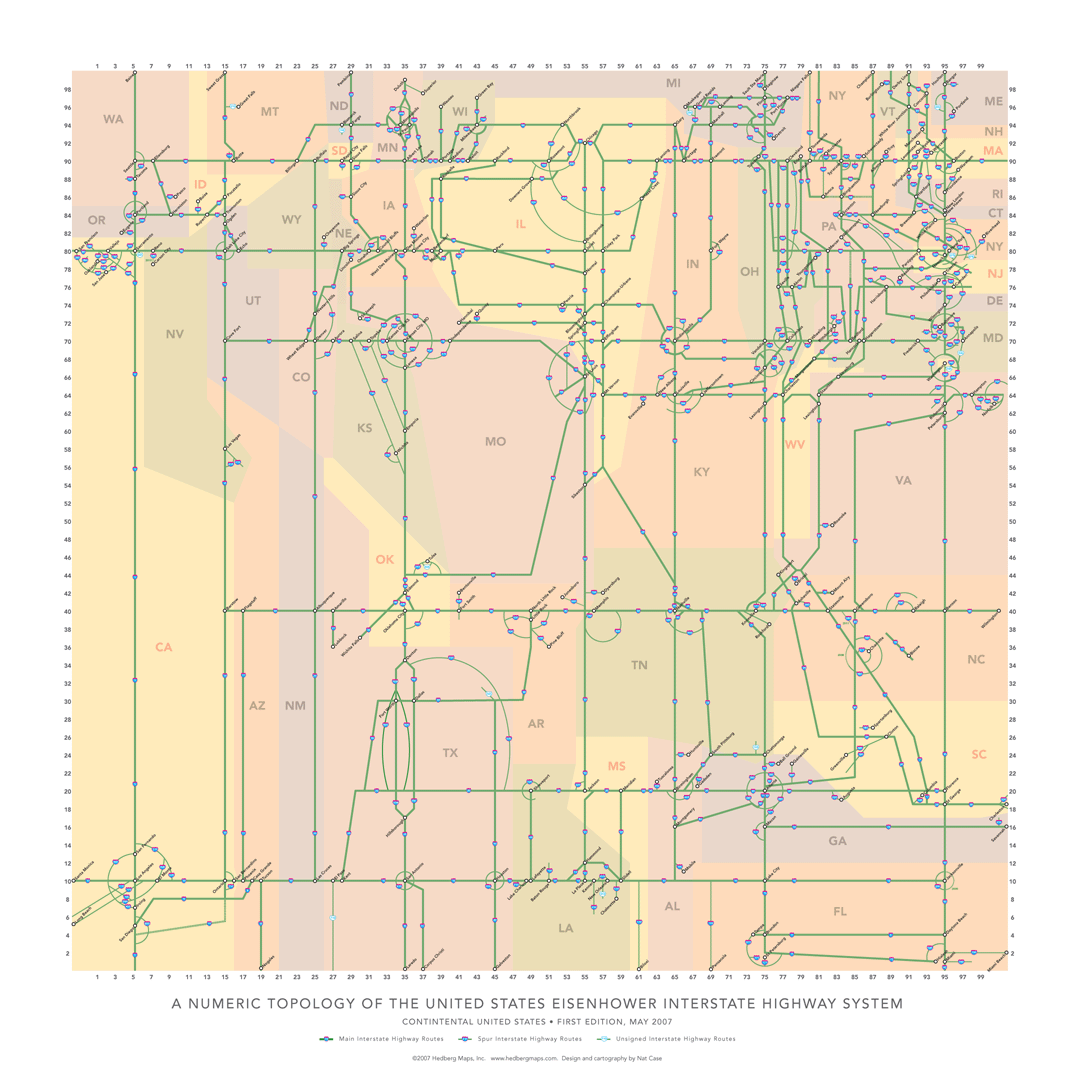
I wanted to find some way to include all the 3-digit spurs and eccentric connections in the system, while remaining abstract. To get a grip on what needed to connect where, I decided to make a sketch based on the system’s numbering system: east-west routes are even, and run from 2 to 98 (in theory), south to north; north-south routes are odd and run from 1 to 99 (in theory), west to east. And routes ending in 0 and 5 are considered the core network, the spine of the national system.
This sketch ended up looking pretty interesting on its own, so with Hedberg Maps’ support, I executed it as a poster, reconforming America’s geography to the square grid formed by these spine routes. I used only straight lines and circular arcs, and got the entire system, topologically correct, on one sheet. It is, of course, completely useless as a planning or navigation tool, but I think it gives an interesting and unusual perspective on a network we take for granted.
Mr Yates took exception to this map. I talk about that peculiar encounter more in my blog.